Submarine Cable Criticality
Which cables matter most, and which ones are most likely to break due to geophysical events? We layer geological hazard data on top of existing cable network maps to find the spots where risk concentrates.
A single submarine cable failure is disruptive for the country it serves. The deeper concern is what happens when several countries route through the same hub, and that hub sits in a volcanic zone or a cyclone corridor. That is where single points of failure trigger regional disruption.
We draw on Northwestern University's Calypso which takes real traceroute data and maps it onto submarine cable paths, revealing which cables carry which countries' traffic. We supplement this with geological hazard models to identify landing stations that sit in volcanic or cyclone risk zones. Taken together, these answer two questions that matter: which cables would cause the most damage if they failed, and which ones face the highest physical risk.
What we are doing
- Working with Northwestern University on the Calypso tool, which maps traceroutes to submarine cables
- Validating Calypso against NZ ISP data
- Modeling volcanic risk to cable landing stations
- Tracking cable builds and delays across the region
Potential disaster scenarios we are modelling
Scenario 1: Earthquake in Fiji
Fiji is a central location in the South Pacific. Not only for telecommunications, but also for trade and tourism to other countries in the region. This also means that any disasters that happen in Fiji have potential cascading effects to other countries in the area.
The area has a long seismic history, with the most destructive earthquake hitting in 1953. This event is of particular interest due to the damage done to Suva, the capital. The region around Fiji also has active active volcanism, including in the nearby Tofua and Kermadec arcs.
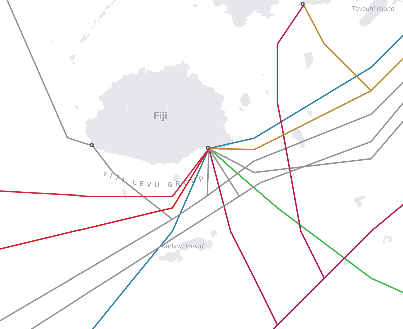
When we look at the submarine cable map we can see that the majority of the cables that go to Fiji land at Suva. This means that not just Fiji, but Suva in particular acts as a hub for multiple submarine cables. A large scale outage here would not just disrupt telecommunications within Fiji, but also Tonga and Vanuatu which currently rely on Fiji for their submarine cable connectivity. There are already plans to increase redundancy to these countries, with a spur of the Hawaiki cable to Tonga going live early 2026. For Vanuatu, the Tamtam cable is scheduled to go live at the end of 2027, connecting to New Caledonia, reducing their reliance on a single submarine cable to Fiji.
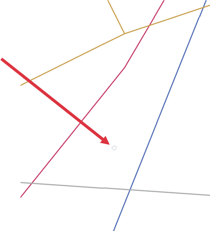
Scenario 2: Niuafo’u Volcano Caldera Collapse
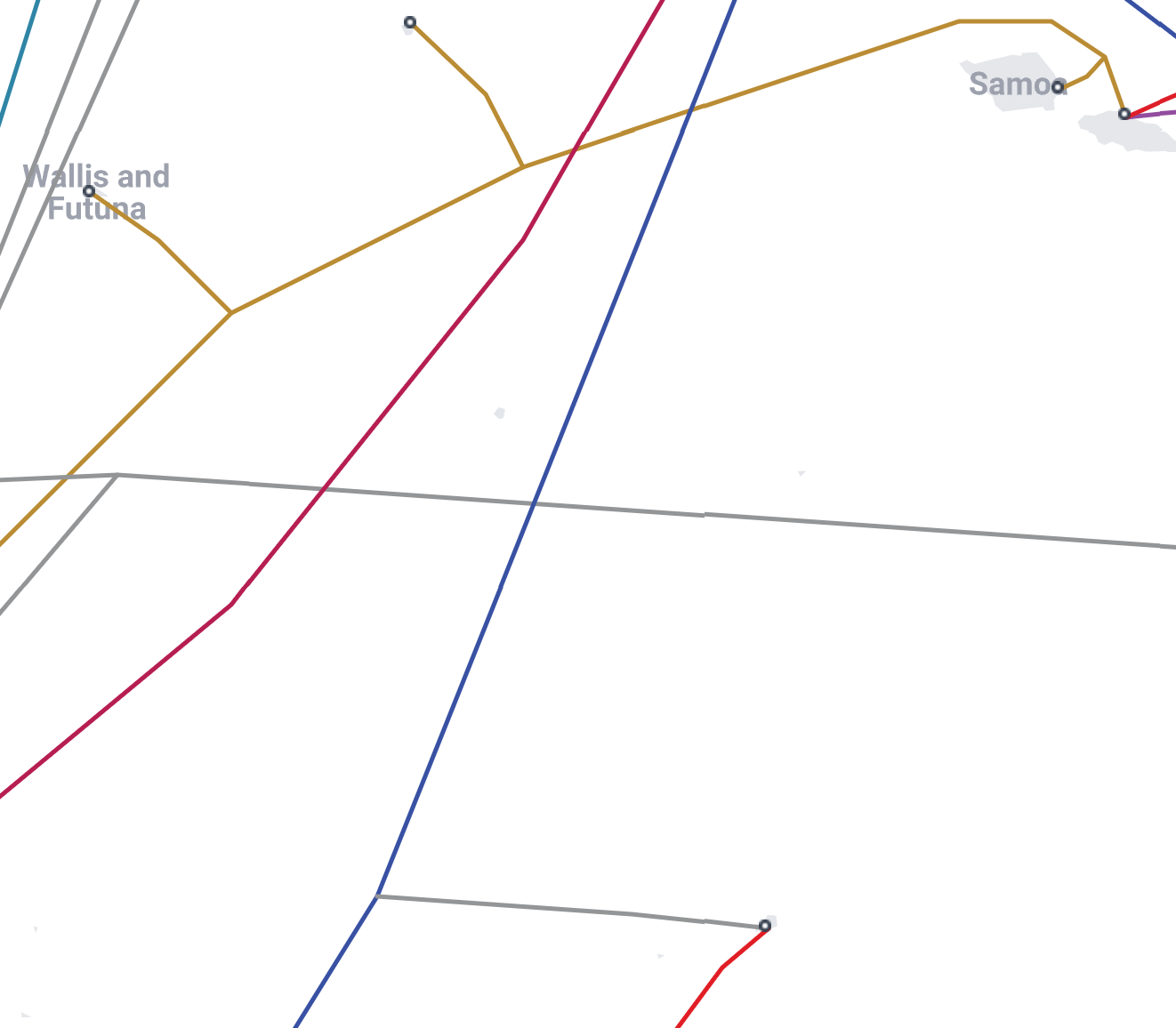
Situated in the middle of Fiji, Tonga, Samoa, American Samoa and Wallis and Futuna, the Niuafo'u volcano is in a prime location to cause damage in the area. While the first image gives you an idea of its location, the zoomed in version gives us a much better idea of the shape of this volcano. The structure of Niuafo'u is strikingly similar to that of the Hunga Tonga Hunga Ha’apai eruption, whose shockwaves were detected around the world. The Hunga volcano also caused large-scale damage to both the domestic and international cables for Tonga. The damage was due to the volcano's caldera collapsing resulting in submarine pyroclastic density currents that traveled over 90km to damage these cables.
Niuafo'u is located next to two out of three of New Zealand's transpacific cables. The volcano is also expected to be of similar magnitude to the Hunga Volcano with the potential to also take out the Tui-Samoa cable. What is more concerning is the new Bulikula cable between Fiji and French Polynesia that is due to go online in late 2026/early 2027.
Scenario 3: Samoan Earthquakes

Samoa and American Samoa are neighbouring island nations with a close proximity to a plate boundary that can produce earthquakes of magnitude 8 and higher. Similar to the caldera collapse scenarios that we discuss in scenario 2, earthquakes at the plate boundary have the potential to create underwater mass flows that could cut the cables surrounding the islands, as well as cause tsunamis. This was the case in 2009 where a magnitude 8.1 earthquake caused extensive damage in the area and loss of life in Samoa, American Samoa and Tonga.
Scenario 4: Cyclone with massive flooding in Samoa
This is the most likely scenario, especially as severe weather events are becoming more common. While the focus of the other scenarios are on submarine cables getting damaged, this instead shifts the focus to power infrastructure and onshore damages. This is especially the case for areas outside of Fiji that rely on their infrastructure to host services.
The damage that Cyclone Gabrielle did to New Zealand's infrastructure on the East coast of the North Island serves as a prime example. This was the costliest cyclone in the South Pacific with the affected areas not just losing power but also communication in the area.This combination broke vital communication links when they were needed the most.
Scenario 5: Compund events
Whereas our other scenarios follows more specific examples, this is a more general case that is a combination of those that we described above. The area that we are studying all have a close proximity to each other. Because of that, these scenarios cannot be considered in isolation, as it is likely that a disaster in one area will affect the neighbouring islands as well.
Our scenarios also cover different types of geohazards, while one country might be affected by an earthquake or volcano eruption, the neighbouring country could be affected by the resulting tsunami. With these cases it is easy to see how they might be related, however there is nothing preventing this to happen while the area is experiencing a cyclone. The additional constraints do not have to be due to other geohazards in the area. One of the reasons the recovery process in Tonga took as long as it did, is that this was in the middle of COVID and Tonga had its borders shut since 2020. It wasn't until the recovery process that Tonga saw its first community case of COVID spread, where it was detected in port workers distributing foreign aid.
Each of these cases introduces more than enough complexity as it is, but it is when there are multiple of these scenarios occurring at a similar time that we start to see the impact compounded. Invariably, the most vulnerable communities are affected the most, as they have to wait until resources become available.